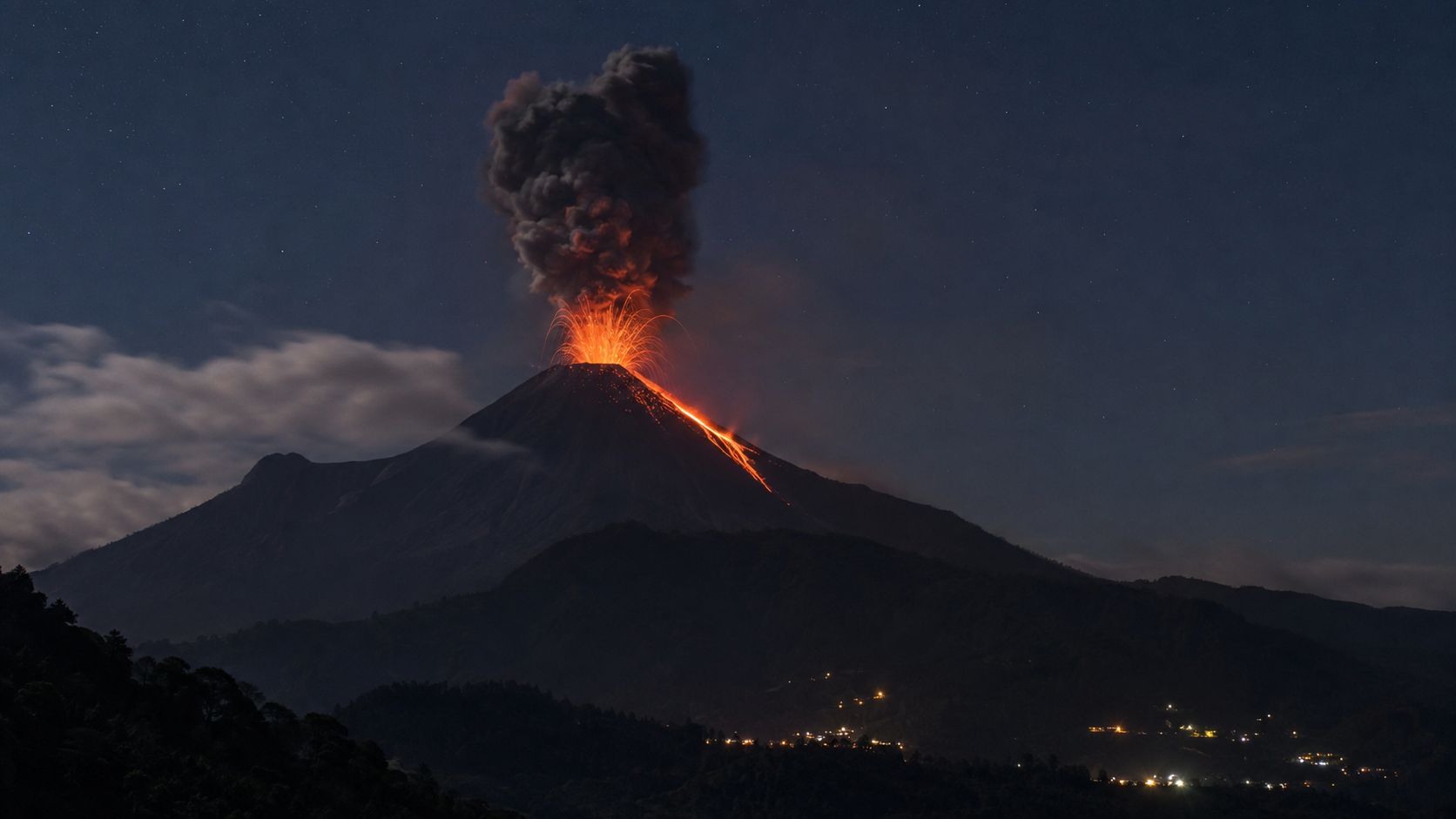
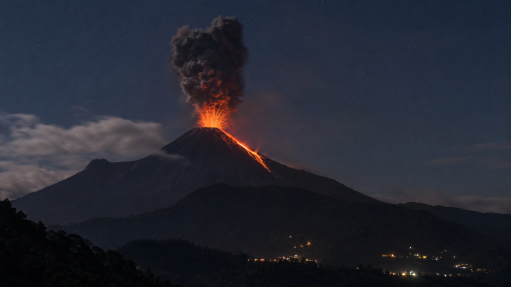
Guatemala’s Fuego Volcano often looks like a mountain performing for the cameras. At night, glowing fragments rise above its summit. By day, grey ash clouds curl into the sky. From a distance, the scene can appear spectacular, even beautiful.
But Fuego is not a natural fireworks display.
Its eruptions can produce fast-moving clouds of scorching gas, ash and rock called pyroclastic flows. These currents can rush down the volcano’s steep ravines with little warning. Ash can spread far beyond the crater, while rain can transform loose volcanic debris into destructive rivers of mud known as lahars.
So why does Fuego erupt so frequently? Why are some eruptions manageable while others become deadly? And how do scientists monitor a volcano that rarely seems completely quiet?
The answers lie deep beneath Central America, where one tectonic plate is steadily being pushed below another.
Where Is the Fuego Volcano?
Volcán de Fuego, Spanish for “Volcano of Fire”, rises in southern Guatemala, roughly 40 kilometres southwest of Guatemala City. It stands beside Acatenango and overlooks the historic city of Antigua.
Fuego is a stratovolcano, built over time from alternating layers of lava, ash and fragmented volcanic rock. Its steep, almost textbook volcanic shape may look orderly, but the system beneath it is anything but calm.
The Smithsonian Institution’s Global Volcanism Program describes Fuego as one of three large stratovolcanoes overlooking Antigua. Recorded eruptions stretch back to the sixteenth century, and its present eruptive period began in 2002. Its usual activity includes explosions, ashfall, block avalanches, lava flows, pyroclastic flows and lahars. Smithsonian Global Volcanism Program
In other words, Fuego does not simply “wake up” once every few centuries. It behaves more like a restless pressure valve that repeatedly releases gas and magma.
Why Does Fuego Erupt So Often?
Fuego sits on the Central American Volcanic Arc, a chain of volcanoes extending through Guatemala, El Salvador, Honduras, Nicaragua, Costa Rica and Panama.
Off Guatemala’s Pacific coast, the oceanic Cocos Plate moves beneath the Caribbean Plate. This process is called subduction.
As the descending plate travels deeper into Earth, it releases water and other volatile substances into the hot mantle above it. These materials lower the melting point of the surrounding rock, helping magma form. Because magma is less dense than solid rock, it begins rising toward the surface.
The journey is not a straight elevator ride from the mantle to the crater. Magma can collect in underground storage zones, move through cracks and mix with newer batches arriving from below. Pressure changes, fresh magma and expanding gases can eventually force molten rock upward through the volcano’s conduit.
Fuego’s magma has generally become more mafic, or richer in magnesium and iron, over time. Much of its historical eruptive material is basaltic. Such magma can flow more readily than very silica-rich magma, but that does not make Fuego harmless. It still contains dissolved gases, and those gases expand dramatically as pressure falls near the surface. Smithsonian Global Volcanism Program
Imagine opening a shaken bottle of fizzy drink. While the cap is closed, gas remains trapped under pressure. Once the pressure drops, bubbles expand and the contents escape rapidly. A volcano is vastly more complicated and considerably less polite but the pressure principle is similar.
What Happens During a Typical Fuego Eruption?
Fuego frequently produces Vulcanian explosions: short, forceful bursts that eject ash, gas, blocks and glowing fragments from the crater.
Some explosions send incandescent material above the summit and trigger avalanches down the upper slopes. Lava may spill into one or more ravines. Winds can carry fine ash over nearby villages, farmland and transport routes.
Many such events remain relatively limited. The danger rises sharply when the eruption rate increases, a tall ash column becomes unstable, or accumulated hot material collapses. That is when pyroclastic density currents may form.
What Is a Pyroclastic Flow?
A pyroclastic flow is a turbulent, ground-hugging mixture of hot gas, ash and broken volcanic rock. Scientists also use the broader term pyroclastic density current.
These currents can form when an eruption column becomes too dense to remain airborne and collapses under gravity. They can also begin when unstable, hot volcanic material collapses from the crater or the front of a lava flow.
Once moving, the current follows steep slopes and low-lying channels. Fuego’s ravines can funnel the material away from the crater and toward lower ground.
The U.S. Geological Survey says pyroclastic flows can travel at tens of metres per second and may reach temperatures above 800°C. Even smaller flows can destroy buildings, forests and farmland. Survival is unlikely in their direct path because they can kill through extreme heat, impact, burial and inhalation of hot ash and gas. USGS Volcano Hazards Program
This explains why “just run away when you see it” is not a safety plan. By the time a pyroclastic current is visible nearby, escape may be impossible. Evacuation must happen before it arrives.
Why Are Fuego’s Ravines So Important?
The volcano’s slopes are cut by deep ravines, locally called barrancas. They act as natural pathways for lava, rock avalanches, pyroclastic currents and lahars.
That geography can sometimes concentrate volcanic material away from certain areas. However, it can also carry hazards several kilometres downslope. Communities near a ravine may face much greater danger than another settlement located at a similar distance from the crater.
This is why a simple circular “danger radius” cannot tell the whole story. Volcanic-risk maps must account for valleys, slope angles, drainage systems, previous deposits and the likely direction of future flows.
The volcano does not consult a compass before erupting. Topography helps decide where its material travels.
Ash Is More Than a Dirty Nuisance
Volcanic ash is not soft ash like the residue from burnt paper. It consists of tiny, abrasive pieces of rock, minerals and volcanic glass.
Fine ash can irritate the eyes and respiratory system, contaminate water supplies, reduce visibility and damage machinery. It can affect crops and livestock, disrupt roads and create problems for aircraft. When ash becomes wet, it grows much heavier and may overload roofs.
The effects depend on the amount of ash, particle size, wind direction, rainfall and the strength of local buildings. A village can therefore experience serious ashfall even when lava and pyroclastic flows remain confined to the volcano’s slopes.
People in affected areas should follow official guidance, remain indoors when advised, protect water and food, and use suitable masks or face coverings to reduce ash inhalation. Ash should be dampened carefully before cleaning so it does not simply return to the air, but roofs must not be overloaded with water.
What Are Lahars and Why Can They Occur After an Eruption?
An eruption can end while its hazards continue.
Fuego lies in a region with a pronounced rainy season. Rainwater can mix with loose ash, sand, boulders and other debris on the slopes, producing a lahar. It may begin as a muddy flow and grow as it picks up more sediment, rocks, branches and water.
Lahars travel down river valleys and ravines, sometimes behaving like rapidly moving wet concrete. They can damage bridges, roads, farms and communities far from the crater.
Research highlighted by Guatemala’s INSIVUMEH identifies lahars as one of Fuego’s most frequent hazards. Scientists are studying their seismic and infrasonic signals to improve early detection, because poor visibility and sudden rainfall can make visual confirmation difficult. INSIVUMEH scientific publications
This creates an important lesson: blue sky above the crater does not automatically mean every downstream area is safe.
Why Was the 2018 Eruption So Devastating?
On 3 June 2018, Fuego produced an unusually intense eruption. The eruption column sent ash high into the atmosphere, while pyroclastic currents travelled more than 11 kilometres in some channels. Communities on the volcano’s southern side were overwhelmed, and more than 100 deaths were officially confirmed.
The disaster showed how quickly Fuego can shift from familiar background activity to a major emergency. It also demonstrated the danger of treating frequent explosions as routine. When people live beside an active volcano for years, normal activity can create a false sense of predictability.
Fuego’s daily or weekly behaviour does not guarantee the size of its next eruption. Scientists can identify changes and probabilities, but they cannot promise an exact time, route and magnitude for every dangerous event.
How Do Scientists Monitor Fuego?
Guatemala’s INSIVUMEH monitors Fuego using several kinds of evidence. No single instrument provides the complete answer.
Seismometers detect vibrations caused by moving magma, volcanic explosions, rockfalls and lahars. Changes in the number, strength or type of signals may indicate a change inside the volcano.
Infrasound sensors record very low-frequency sound waves produced by explosions and moving flows. These signals can help confirm activity even when cloud, fog or darkness hides the crater.
Cameras and satellite observations allow scientists to examine ash columns, glowing material, lava and thermal changes. Satellites can also help track ash drifting through the atmosphere.
Gas measurements provide clues about magma movement. Sulphur dioxide and other gases can escape as magma rises and loses pressure, although gas readings must always be interpreted alongside seismic and visual evidence.
Field observations and community reports add essential ground level information, including ashfall, rumbling, changes in rivers and the movement of material through ravines.
Scientists combine these signals to issue bulletins, update hazard assessments and advise disaster management authorities. Monitoring cannot stop an eruption, but it can turn otherwise invisible changes into information that supports evacuation and road closures.
Can Fuego’s Eruptions Be Predicted?
Scientists can sometimes recognize that the probability of an eruption is increasing. They may detect stronger tremor, more explosions, rising gas emissions, crater incandescence or changes in lava output.
But volcanic forecasting is not like predicting a solar eclipse. Fuego has an open, frequently active system, and its behaviour can change rapidly. The same warning sign may lead to a small event on one occasion and a larger eruption on another.
Forecasts therefore describe likely scenarios rather than guaranteeing a precise outcome. Authorities may order a preventive evacuation even if the worst scenario does not occur. That is not a failed forecast. It is risk management when the cost of waiting could be catastrophic.
Why Do People Continue Living Near Fuego?
Volcanic regions are not only places of danger. Weathered volcanic material can create productive soils, supporting coffee, maize and other crops. Families have social, cultural and economic ties to the land. Antigua and the surrounding highlands also attract tourists, creating jobs and business opportunities.
Relocating permanently is neither simple nor desirable for every community. The realistic goal is therefore not to pretend the volcano can be removed from daily life. It is to reduce exposure through trusted warnings, evacuation routes, shelters, hazard education and sensible land-use planning.
Tourism also requires discipline. Watching Fuego from designated safe locations is very different from approaching restricted areas or entering a ravine to capture dramatic footage. A spectacular video is not worth becoming part of the next hazard map.
The Larger Lesson From Fuego
Fuego reminds us that a volcano does not need to remain silent for centuries before it becomes dangerous. Persistent activity can be deceptive. Small explosions may be common, yet the system can still produce a much larger event.
The greatest hazards are not always the glowing lava that attracts attention. They may be a collapsing ash column, an almost invisible current of hot gas and debris, abrasive ash falling far downwind, or a rain triggered lahar arriving after the eruption appears to have ended.
Understanding these processes replaces spectacle with perspective. Fuego is magnificent, but it demands respect not only when it dominates the headlines, but every day it quietly smokes above Guatemala.
Frequently Asked Questions
Is Fuego the most active volcano in Guatemala?
Fuego is one of Guatemala’s most active volcanoes and among the most persistently active in Central America. It has produced frequent recorded eruptions for centuries.
Is Fuego close to Guatemala City?
The volcano lies roughly 40 kilometres southwest of Guatemala City. It is also close to Antigua and several rural communities situated around its slopes and drainage channels.
What is the biggest danger from Fuego?
Pyroclastic flows are among the most immediately lethal hazards because they are extremely hot and fast. Ashfall, lahars, lava flows, falling blocks and respiratory impacts can also cause serious harm.
Can people outrun a pyroclastic flow?
No reliable escape is possible once a pyroclastic flow is nearby. These currents can move at very high speeds. People in threatened zones must evacuate before a flow begins or arrives.
What is the difference between lava and a pyroclastic flow?
Lava is molten rock flowing across the ground. A pyroclastic flow is a turbulent mixture of hot gases, ash and broken rock. Pyroclastic flows usually travel much faster and can devastate a broad channel very quickly.
Can heavy rain make the volcano more dangerous?
Yes. Rain can remobilize loose volcanic ash and debris, creating lahars that rush through ravines and river valleys even when no major eruption is occurring.
Read other articles at https://infopillstv.com